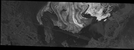
Full Display of BERINGGLACIERAK20030907M1M

Standard Browse

Scene Metadata
Data Set Attribute Attribute Value
Entity ID BERINGGLACIERAK20030907M1M
Platform U.S. NATIONAL IMAGERY SYSTEMS
Acquisition Date 2003/09/07
Map Projection UNIVERSAL TRANSVERSE MERCATOR
UTM Zone 7N
Ellipsoid WGS-84
Pixel Size X 1.000000
Pixel Size Y 1.000000
Units METERS
Data Type UNSIGNED EIGHT-BIT INTEGER
Product Format GEOTIFF OR GEOPDF
TIF Vendor ID beringglacierak_20030907_m_1m_tif
PDF Vendor ID beringglacierak_20030907_m_1m_pdf
Publication Date 2009/12/01
Date Entered 2010/12/28
Date Updated 2020/04/17
Center Latitude 60°09'40.81"N
Center Longitude 143°28'13.55"W
NW Corner Lat 60°13'54.38"N
NW Corner Long 143°49'06.37"W
NE Corner Lat 60°13'54.38"N
NE Corner Long 143°07'20.74"W
SE Corner Lat 60°05'27.24"N
SE Corner Long 143°07'20.74"W
SW Corner Lat 60°05'27.24"N
SW Corner Long 143°49'06.37"W
Center Latitude dec 60.1613365
Center Longitude dec -143.4704315
NW Corner Lat dec 60.231772
NW Corner Long dec -143.818435
NE Corner Lat dec 60.231772
NE Corner Long dec -143.122428
SE Corner Lat dec 60.090901
SE Corner Long dec -143.122428
SW Corner Lat dec 60.090901
SW Corner Long dec -143.818435