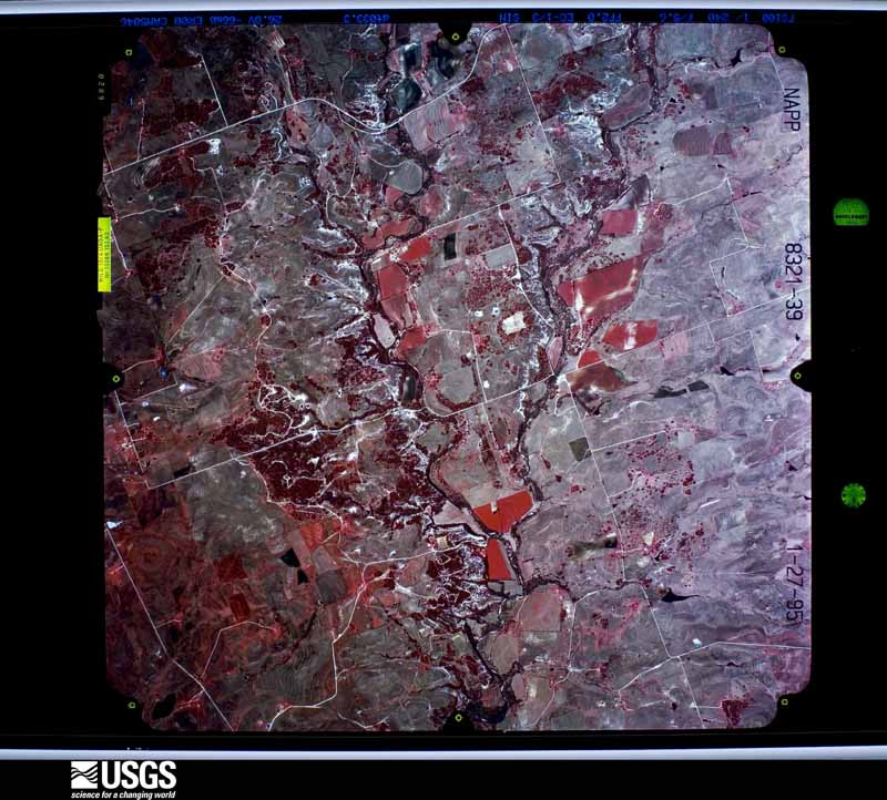
| Data Set Attribute | Attribute Value |
|---|---|
| Entity ID | NP0NAPP008321039 |
| Project | NAPP |
| Project Number | 9505 |
| Roll | 8321 |
| Frame | 39 |
| Acquisition Date | 1995/01/27 |
| Camera | 5046 |
| Lens | 13086 |
| Calibrated Focal Length | 152.928 |
| Film Type | Color Infrared |
| FlightLine | 0981E |
| Station | 219 |
| State | TX |
| County | BURNET |
| Center Latitude | 30°48'45"N |
| Center Longitude | 98°01'52.50"W |
| NW Corner Lat | 30°51'12.85"N |
| NW Corner Long | 98°04'44.65"W |
| NE Corner Lat | 30°51'12.85"N |
| NE Corner Long | 97°59'00.35"W |
| SE Corner Lat | 30°46'17.15"N |
| SE Corner Long | 97°59'00.35"W |
| SW Corner Lat | 30°46'17.15"N |
| SW Corner Long | 98°04'44.65"W |
| Center Latitude dec | 30.8125 |
| Center Longitude dec | -98.03125 |
| NW Corner Lat dec | 30.85357 |
| NW Corner Long dec | -98.07907 |
| NE Corner Lat dec | 30.85357 |
| NE Corner Long dec | -97.98343 |
| SE Corner Lat dec | 30.77143 |
| SE Corner Long dec | -97.98343 |
| SW Corner Lat dec | 30.77143 |
| SW Corner Long dec | -98.07907 |