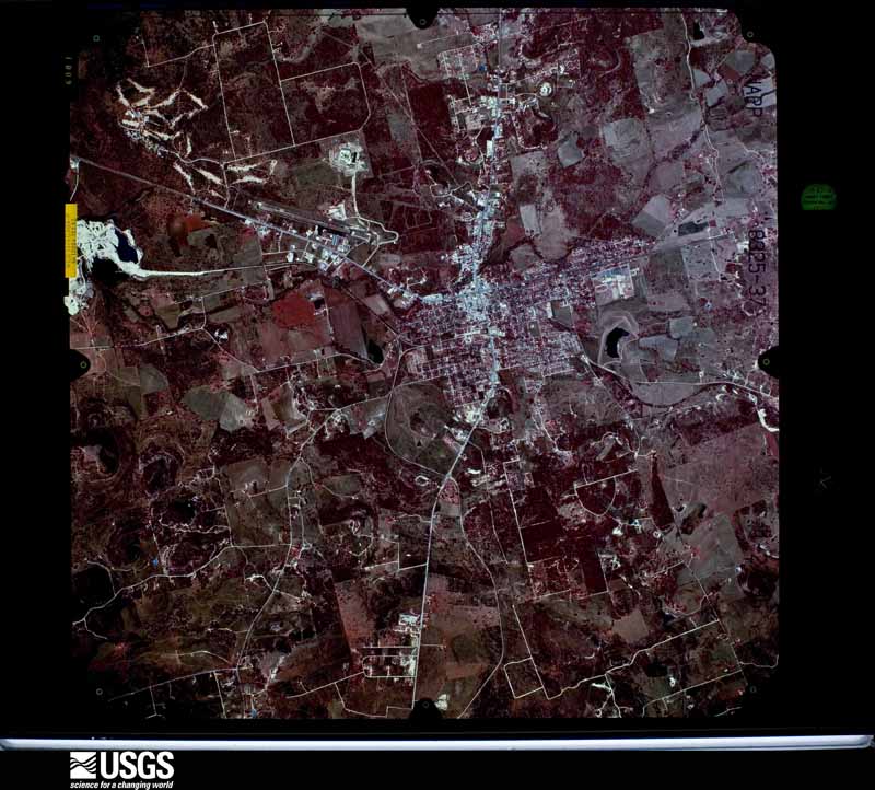
| Data Set Attribute | Attribute Value |
|---|---|
| Entity ID | NP0NAPP008325037 |
| Project | NAPP |
| Project Number | 9505 |
| Roll | 8325 |
| Frame | 37 |
| Acquisition Date | 1995/01/27 |
| Camera | 5063 |
| Lens | 13094 |
| Calibrated Focal Length | 152.82 |
| Film Type | Color Infrared |
| FlightLine | 0982W |
| Station | 217 |
| State | TX |
| County | BURNET |
| Center Latitude | 30°45'00"N |
| Center Longitude | 98°13'07.50"W |
| NW Corner Lat | 30°47'27.85"N |
| NW Corner Long | 98°15'59.54"W |
| NE Corner Lat | 30°47'27.85"N |
| NE Corner Long | 98°10'15.46"W |
| SE Corner Lat | 30°42'32.15"N |
| SE Corner Long | 98°10'15.46"W |
| SW Corner Lat | 30°42'32.15"N |
| SW Corner Long | 98°15'59.54"W |
| Center Latitude dec | 30.75 |
| Center Longitude dec | -98.21875 |
| NW Corner Lat dec | 30.79107 |
| NW Corner Long dec | -98.26654 |
| NE Corner Lat dec | 30.79107 |
| NE Corner Long dec | -98.17096 |
| SE Corner Lat dec | 30.70893 |
| SE Corner Long dec | -98.17096 |
| SW Corner Lat dec | 30.70893 |
| SW Corner Long dec | -98.26654 |